![]()
September 2002
FileMaker at Area 51
by Brian Dunning
digg this article | del.icio.us this article
 Those
of you who have endured this column over the years have perhaps
noticed my predilection for traveling to interesting places and
taking notes in FileMaker Mobile. If so, you've also noticed that
this has rarely served a useful purpose, other than to instruct
and entertain those who are very easily entertained.
Those
of you who have endured this column over the years have perhaps
noticed my predilection for traveling to interesting places and
taking notes in FileMaker Mobile. If so, you've also noticed that
this has rarely served a useful purpose, other than to instruct
and entertain those who are very easily entertained.
For a while I've had a video on my web site about a trip to Area 51 that I took with my brother Todd and my friend John Countryman, who are both pilots and have creative ways of finagling free flight time. But until this moment, I've never revealed the dark secret about the role FileMaker Mobile played in that adventure. The dark secret is that I used FileMaker Mobile on that adventure. I used it to log GPS waypoints of interesting spots along the journey, taking some field notes at each. And now, you too can retrace our steps by downloading the database from my web site at https://www.briandunning.com/vibrations/. There are little thumbnail pictures, notes, and coordinates for a dozen or so intriguing waypoints.
Finding information on how to get to Area 51 is not difficult, since there are about a thousand web sites devoted to it. Area 51 is the unofficial pop-culture name for one of the airfields inside Nellis Air Force Base in Nevada, north of Las Vegas. It's rumored that the government keeps alien visitors there, and routinely flies captured alien spacecraft, in their ongoing quest to deceive the public and undermine society. It's also known to have been an operating base for the A-12/SR-71 spy planes, and reasonably presumed to be a current base for whatever type of aircraft replaced those when they were retired. Our optimism to meet and greet aliens was guarded, but we were hopeful of seeing some interesting contrails at night.
So our first step was to fly to North Las Vegas airport, which is closer to Nellis and a lot more convenient for a private plane than the bigger international airport in town. It's interesting to note that North Las Vegas has perhaps the friendliest and most helpful air traffic controllers for private planes anywhere in the country. Friendly and helpful air traffic controllers are often a surprise, but they shouldn't be in a town that makes so much money welcoming visitors. Once on the ground, we rented a Jeep and headed north. Since I didn't get to fly the plane, I got to drive the Jeep. Todd and John were duly impressed.
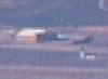
One of the first places you get to, and one of the first waypoint records in the FileMaker database, is what is variously known as "The Black Mailbox" or "The White Mailbox," right on the side of the main highway at the turnoff for Groom Lake Road. It's actually white, but the name Black Mailbox persists, perhaps as a way to add mystique, since enthusiasts consider this to be where the aliens receive their mail. The mailbox could use the mystique. There's a large ranch between the mailbox and Area 51, and the rancher has clearly stenciled "THIS IS FOR THE RANCH, NOT AREA 51" all over his suffering mailbox, but it does little good. The mailbox is thickly coated in graffiti and stickers, and when we were there at ten o'clock at night, there were a half dozen cars parked and crowds standing around.
An uneventful drive down a long, well-maintained unpaved road brings you to the boundary of Nellis Air Force Base. Here are all the signs you see on Discovery Channel documentaries about threats to use deadly force and warnings against taking photographs. You'll find duplicates of these signs at every military base in the country. There is no fence or gate, but there is a large turnout where there is always an alien watcher or two camped out. You're still quite a few miles from Groom Lake and the road twists through low hills, so you can't begin to see anything from where we had to stop. We'd heard the stories about "thugs" and "cammo dudes" who won't speak to you but try and intimidate you with their presence and chase away the curious. I hoped we'd get chased away, and I wasn't disappointed. We hadn't been there five minutes when a white Jeep Cherokee up on the hillside started flashing us with a big light. I was for flashing him back, but my companions outvoted me, and we grudgingly drove away. As long as you remain outside the boundary and don't take pictures, you're not doing anything wrong, and I was curious to see if they'd ever actually come down and talk to us.
So much for the Jeep portion of the trip. The next morning we rose early and headed back for our plane, because the most interesting part of the trip was ahead: aerial surveillance of Area 51.
Fortunately our trip was a few months prior to September 11. You probably wouldn't be able to fly the same route today, at least not without quickly drawing some wingmen flying much more expensive and durable hardware than you. Since September 11, private pilots all carry little cheat sheets reminding them what all the wing-wagging signals mean and how to reply when the F-16 signals you to land.
The first thing you learn flying over Nellis is that Area 51 is by no means unique. There are airstrips all over the place, many with their own hangars and complexes. People talk a lot about how Area 51 is "uncharted" and "not on the map," but this is convention: none of the airstrips inside air force bases are on the map. We saw at least a dozen inside Nellis, and all are equally uncharted. Area 51 is the biggest one we saw, although we stayed put on the perimeter and couldn't see very far inside due to all the mountains. Area 51 is right there on the border of Nellis AFB, so it's pretty easy to see. It's certainly not the most secluded site available for secret alien experiments.
Nevertheless they seem to guard it pretty jealously. They have this really huge radar array on top of the biggest peak around, and any time you walk within fifty miles of the place, there are little red laser dots on your forehead. The pre-September 11 perimeter of the Nellis Military Operating Area (the boundary you want to stay on the good side of) is a zig-zagging stair step pattern, and to get the best views, we cut in as sharply as we could while keeping a fair buffer zone between ourselves and that big scary red line on the GPS screen. It may have amused us, but it didn't amuse the guys in Area 51's air traffic control tower. One of them who was in a salty mood came on the radio and said:
"Sierra Papa, what is your destination?"
We refrained from stating what he already knew, that we were just liquoring around up there trying to peer inside and see aliens, and instead told him we were on our way to Tonopah, a tiny fuel depot in the middle of the Nevada desert.
"Would you like a direct vector to Tonopah?"
So we increased the buffer zone a bit. It was like Han Solo telling Chewbacca to "Keep your distance, but don't look like you're keeping your distance." Well, it was kind of like that, except that we were only in a cheesy plane and not a spaceship, and were all dorks and not as cool as Han Solo, but otherwise it was just like that.
Eventually we did make it to Tonopah, where we refueled for the trip home, and marveled at the experience of having been chased away from the people who guard the aliens both on land and in the air. I've always felt that if you're not able to accomplish anything noteworthy with your own life, the next best thing is to get chased away by people who have at least made the Discovery Channel. And if you can document the episode in FileMaker Mobile, you've created an enduring record that just might outlive you, and give your grandchildren something to be proud of. All of this stuff, and some other cool things not mentioned here, appear in the FileMaker database. Download it and check it out.